 March 23, 1988
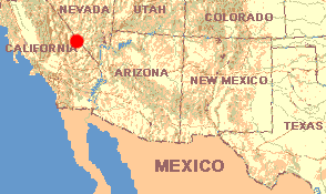
CALIFORNIA: Inyo County
Through Death Valley
March 23, 1988
Between two and four o'clock in the morning I'm awakened as Henry rocks in
the wind and sand grains blast onto his metal side. For the rest of the night the wind
blows without ever letting up. Sometimes roarings pass above us and in the darkness those
sounds are so profound that they cause in me real apprehension.
With dawn's light I sit watching fast-moving clouds of brown sand sweep low across the dunes and the gravel road on which I'm parked. As the light grows I'm dumbfounded to see how much sand has insinuated into the car. Having come through the crack between the driver's-side door and the body, beneath the clutch and brake pedals lies at least a gallon of very fine sand. From around the windows and above the windward door, at least a cup of dust has entered and spread itself over food, books and clothing.
Immediately we leave. Within two miles the highway climbs up the valley's slope toward Ibex Pass, at 2090 feet; within ten minutes the air around us is clear and roadside Creosote-bushes no longer shake in the wind, though the rear-view mirror shows the valley behind us still engulfed in gray-brown dust. At the gas station in Shoshone, not even a hint of breeze is stirring. I clean several handfuls of sand from Henry's engine compartment.
From Shoshone we head west on CA Hwy.178 toward Death Valley National Park, hoping to backpack and camp there for maybe a week, as we did at Big Bend. First the highway climbs so steeply to Salsberry Pass at 3288 feet that we must use third gear; then down we coast until we're inside Death Valley, at or below sea level.
Death Valley really is a valley between mountains, more or less running north and south. To the east lie the Grapevine and Funeral Mountains while to the west lies the Panamint Range. Snow mantles the Panamint's higher peaks. Without thinking much about it, I'd say that the Panamint Range looks to be no higher than 3000 feet. Since in one long descent we've just come down from 3288 feet to sea level, I figure that I should have a good feeling for elevations. However, realizing that snow shouldn't appear until around the 9000 foot level, and there's clearly snow in the Panamints, I'm confused. While driving north I pull out my map and see the Panamint's highest peak, Telescope Peak, is in fact 11,049 feet high! Moreover, I've been judging Telescope Peak to lie between seven and ten miles away but the map says it's twenty. As I pass by the lowest point in the U. S., at 282 feet below sea level, I feel completely disoriented.
Many day-use pull-offs appear along the highway, but I'm looking for a road of the kind usually found, where I can drive into the desert and stay for a while. Several nice-looking gravel roads do come along, but each is posted NO CAMPING. Things here look so strange that I decide to go against all custom and check into a formal campground. But all campgrounds either are full or so packed that I simply refuse to enter. Leaving the developed area behind I begin desperately looking for a place where I can at least take a long walk by myself, but now everyplace I find is overrun with tour buses idling their diesel engines while multinational groups of shorts-and-sunglass-wearing, camera-swinging tourists stand about smelling of hotel-room soap. Gradually Death Valley's steep walls begin pressing in and I'm feeling claustrophobic. All the way into, through, and out of Death Valley National Monument I do not stop Henry's engine a single time.
I have not been disappointed with the valley itself, for it could not have been more strange and worth visiting. Between the valley floor's alkali flats and the very steep, often vertical canyon walls rise steeply sloping talus slopes deeply mantled not with the usual sands and silts but with fist- to breadloaf-sized, sharp-edged rocks. These slopes remind me of abandoned lots in the Bronx where brick buildings have collapsed into impassible fields of rubble.
Sometimes the valley walls' contrastingly colored strata are neatly layered but sometimes the colors are so jumbled that the walls have a piebald appearance. Along some stretches of road diffuse populations of Desert Sunflower appear but even here sometimes the off-roaders have left their tire marks, despite the many signs pleading for people to stay on the pavement. In marshy areas where white mineral incrustations rim plant stems, the dominant shrub is Pickleweed. On rocky talus the Desert Holly we met at Silver Lake is abundant, as are the Creosote-bush and Bur-sage.
Other wildflowers and shrubs are seen but I pass them by, just needing to escape from this resort-ized wonderland.