 SMALL-SCALE,
LOCALLY PRODUCED,
COMMUNITY-SUPPORTING
TOURISM AMONG THE
MAYA
IN
YAXUNAH
Yucatán, México
SMALL-SCALE,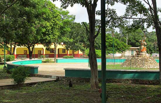
In Yaxunah, whether to visit the cenote, the ruins, to hike or camp, to get a meal or stay overnight, you should first go to the Community Center, shown below:
All roads into Yaxunah quickly arrive at the Town Square with its park, and City Hall. The Community Center is one block southeast of the Town Square, easily visible from the street. It's surrounded by a green, mesh metal fence. Someone is there from 9:30 AM to about sundown, and can set you up for what you'd like to do.
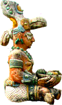
 One
side of the Community Center houses a small museum focusing on the ruin's archaeology, and
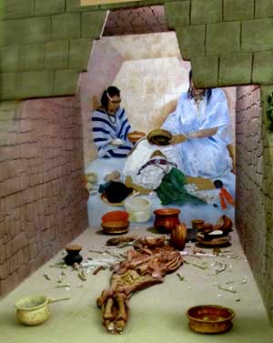
local Maya traditions. At the right you see one of the main displays, a life-size
reproduction of a tomb excavated at Yaxunah.
One
side of the Community Center houses a small museum focusing on the ruin's archaeology, and
local Maya traditions. At the right you see one of the main displays, a life-size
reproduction of a tomb excavated at Yaxunah.
The skeleton in the tomb modeled at the right was found to be headless. Much has been written about the ancient wars that appear to have led to the headless skeleton, and the history is provided in the museum in both Spanish and English. Important archeological publications are on file in the Center's library. You may be interested in our brief history of Yaxunah Ruins. (Historia también in español)
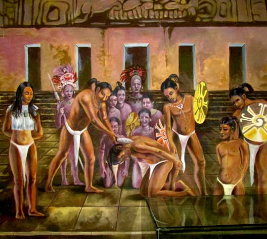
Below you see some of the excellent artwork accompanying the displays:
A botanical garden worth walking through surrounds the Cultural Center, emphasizing plants important to the Maya. Printed literature is available to help recognize and appreciate the various species. The picture below, on the left, shows a strangler fig's ropey stems engulfing a host tree, and at the right you see the bulging trunk of a large Ceiba tree.
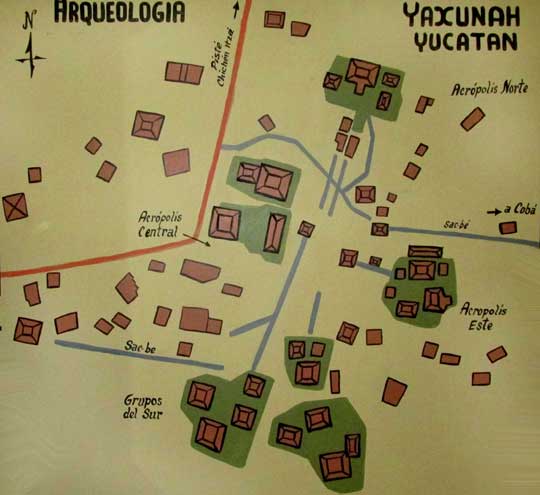
The above map, on the wall of the Yaxunah Community Center Museum, gives a general idea of the size of Yaxunah Ruins just north of the town of Yaxunah. Several important archaeological studies have been conducted there. Several of the buildings in the core zone have been stabilized/consolidated or reconstructed, so there is something to see as you walk around the area, though the grounds are not much cared for and sometimes paths through weeds have to be macheted to get from place to place. The area is off limits to those without a guide from town.
The ancient Maya often constructed straight, elevated causeways within and between their sites. The causeways were made mostly of stone and fill-dirt, and capped with a kind of soft, crumbly or even powdery, white limestone often found in the Yucatan, locally called sascáb. Sascáb is white, so the ancient causeways were white roads shooting through the green forest, and the Maya called them sacbés, which means "white road." By far the longest sacbé in the Maya world is the one connecting the ruins of Yaxunah with the ruins of Cobá 100kms (62mi) to the east, as shown below:
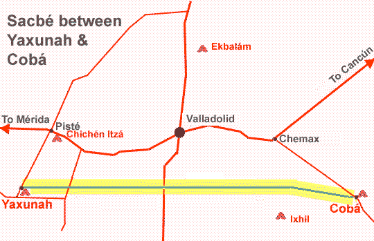
According to Stephan Houston & Takeshi Inomata in The Classic Maya (Cambridge University Press, 2009), the causeway probably was constructed around the 600s. The first evidences of human occupation at Yaxunah are from about 450 BC, so the causeway was added only after Yaxunah had been around awhile. Academic maps show that the causeway is not perfectly straight.
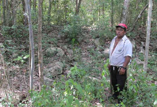
Today the ancient causeway is clearly visible as a slightly raised pile of rocks arranged in a straight line several meters across, the line extending straight for as far as can be determined. Below you see the local guide Don Francisco standing where a forest trail crosses the structure.
When guides take you to see the cenotes, the rejollada and the sacbé, the trail passes over the causeway in several places and sometimes runs along its side, better giving an impression of what it might have been like. Right next to the ruins, however, it's missing. At one point people in Yaxunah's history expected attacks from Cobá, so they ripped out their sacbé and put up defensive walls.
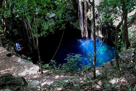
Local folks mainly visit Yaxunah for its pretty, well-maintained cenote, Cenote Lolhá, shown above with midday sunshine showing off its incredibly blue, clear water. The water is deep, so visitors are provided with flotation vests to keep heads above the water, plus ropes strung just above the surface can be held on to for extra security. Cenote Lolhá is much larger than it appears in the picture. Metal stairs descend from the rim into the water. Cenote Lolhá is surrounded by a fence and a small admission fee is charged.
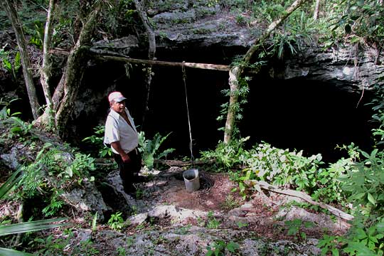
Other cenotes in the area can be reached by hiking, biking or auto, accompanied by a local guide, but these cenotes are mainly just to see, and to have the fun of getting to. For example, deep in the forest there's the cenote shown below:
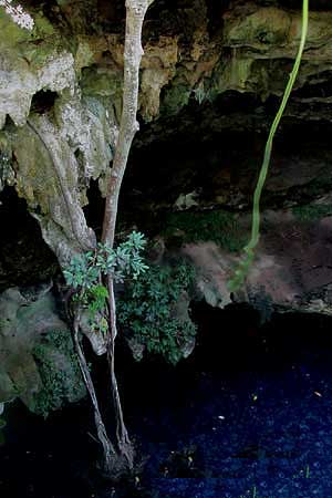 Interesting plants found only in deep shade
and where there's plenty of moisture occur here. Stalactites form along the cenote's
sides. Local people have stories about what seems to be a person's shape down in the
cenote, barely visible in the photo at the right as a dark, full-body silhouette located
at the right of the tip of the greenish vine dangling into the cenote. Nowadays, during
the long dry season, local beekeepers draw water from the cenote for their bees.
Interesting plants found only in deep shade
and where there's plenty of moisture occur here. Stalactites form along the cenote's
sides. Local people have stories about what seems to be a person's shape down in the
cenote, barely visible in the photo at the right as a dark, full-body silhouette located
at the right of the tip of the greenish vine dangling into the cenote. Nowadays, during
the long dry season, local beekeepers draw water from the cenote for their bees.
Not far away there's a large rejollada, like a wide-mouthed cenote with no water at its bottom. In places the rejollada walls form extensive overhangs such as the one shown below:
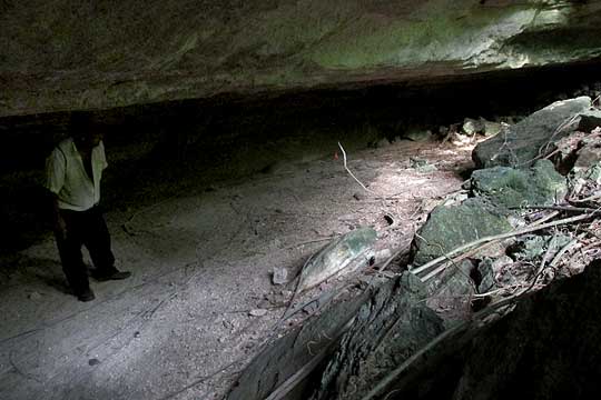
Here the guide can point out what appear to be ancient markings on stones. Also there are special places where hunters sometimes leave special offerings of pozol to enhance their chances of shooting something, as well as niches where groupings of small objects are gathered in consideration of the alux, or gnome-like beings, regarded as living in the area.
Several families in Yaxunah carve wooden masks that are sold in the tourist trade elsewhere. Below you see Don Ignacio carving in his house less than a minute walk from the Community Center.
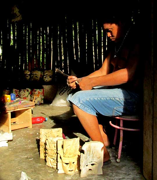
Certain woodcarvers will be happy to show visitors the entire mask-producing process, which should take about half an hour. Visits can be arranged at the Community Center.
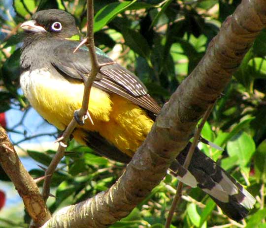
A good way to see a variety of bird species, and maybe glimpse such critters as the coati, fox or even an ocelot, is at dawn on the little forest trails crisscrossing the forest around Yaxunah. Such an experience can be arranged with a local guide.
One reason a fair variety of species can be seen in the area is that habitats range from weedy cornfields to fairly mature forest. The Mayas' slash-and-burn agriculture accounts for many abandoned cornfields displaying various stages of recuperation as they revert to forest, with each successional stage providing its own characteristic set of species.
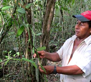 One interesting plant occurring only
spottily in places known by the guides is that of the Vanilla Orchid, from whose fruit
pods the vanilla flavor is extracted, shown at the right. You can see that this unusual
orchid grows as a dangling vine. Several other orchid species also occur in the area as
well as bromeliads.
One interesting plant occurring only
spottily in places known by the guides is that of the Vanilla Orchid, from whose fruit
pods the vanilla flavor is extracted, shown at the right. You can see that this unusual
orchid grows as a dangling vine. Several other orchid species also occur in the area as
well as bromeliads.
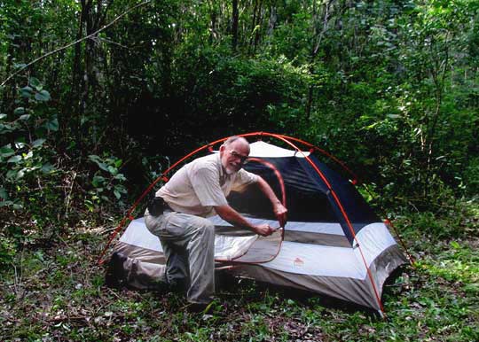
Primitive camping is available in some nicely isolated places, including near the cenotes and rejollada. These sites can be reached by forest road that can be walked, biked or driven slowly over. A local guide must get you situated.
At a very reasonable rate, individuals and families can rent a room in a small, cinderblock building, with the bed equipped with a mosquito net. Often the buildings are used by local families who during the visit move to their thatch-roofed hut next to the cinderblock structure. Many families prefer their thatch-roofed huts, anyway. Lodging should be arranged several days in advance by emailing the address at the bottom of this page.
Meals can be arranged by emailing several days in advance to the address given below.
To visit the cenote, museum or walk around the botanical garden, all you have to do is show up between 9:30 AM and 7 PM, any day of the week. For a tour of the archaeological site, a hike in the woods, camping, for a Maya meal or for lodging overnight, you should make arrangements several days in advance by emailing a volunteer and friend of the community who lives in Mérida, Don Elias, at alcocerpuerto@yahoo.com